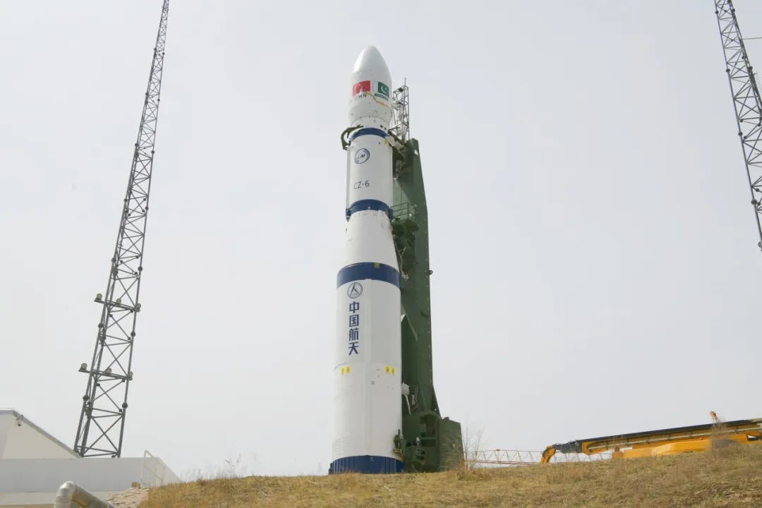
The launch of Pakistan’s indigenous PRSC EO-3 satellite from China’s Long March-6 on 25 April 2026 was accompanied by familiar rhetoric of technological advancement, national pride, and the cultivation of Sino-Pakistani space cooperation. These understandings, however, are not sufficient to convey the more important strategic story. The significance of EO-3 is not in the satellite itself, but in the insights it provides into Pakistan’s journey towards space-based remote sensing. EO-3 marks the start of Pakistan’s transition from single-satellite projects to a multi-layered Earth observation architecture.
This is an important distinction. The number of satellites a country has is no longer the measure of space power in the modern world. Instead, it is based on their ability to operate within an integrated system that produces persistent, reliable, and actionable information. In today’s remote sensing, the architecture is more important than hardware. Pakistan’s previous Earth observation capabilities were platform-based. PRSS-1 and PakTES-1A were launched in 2018 and provided valuable remote sensing data, but were essentially standalone systems. They provided intermittent imagery but were limited by orbital constraints, revisit frequency, and reliance on a small number of platforms to maintain continuous situational awareness.
The PRSC-EO programme proposes an alternative approach. Pakistan is gradually building a constellation of satellites, with the launch of EO-1 in January 2025, followed by EO-2 and now EO-3. This is a significant step, as the real power of Earth observation lies in watching things change over time. Repeated observation is more useful than incremental improvements in image resolution when measuring agricultural productivity, tracking the progress of a flood, measuring progress in infrastructure development, or analysing environmental degradation. EO-3 is seen in this context as part of the overall effort to enhance temporal persistence. Multiple satellites with complementary orbits can create the kind of “persistent awareness” that military planners and policymakers increasingly want, rather than “episodic visibility.”
The EO-3 mission also appears consistent with an emerging shift in Pakistan’s thinking about space. Pakistan’s emerging space architecture increasingly reflects a mission-layered approach in which remote sensing, communications, and navigation capabilities are developed in parallel. Such an approach mirrors broader international trends in which strategic advantage derives from the fusion of Earth observation, positioning, navigation, timing (PNT), and communications networks into a unified information ecosystem. Under this logic, EO-3 should be understood less as a satellite programme and more as one component of a gradually expanding space-enabled intelligence architecture.
This is where the strategic importance of EO-3 becomes apparent. Mission layering is a sign of both technological maturity and the growing need for sustained, multi-domain geospatial awareness in the state. Climate-induced disasters, water stress, rapid urbanisation, glacier melt, and agricultural pressures in Pakistan highlight the need for timely, high-resolution earth observation data for operational use. As a result, a layered observation architecture is designed to enhance conventional security applications and further augment Pakistan’s space capacity and resilience, paving the way for the next phase of the country’s space programme.
The architectural change is also influencing the technological direction of the space programme. According to the available reports, the satellite is equipped with onboard data processing, artificial intelligence-assisted data analysis, and multi-geometry imaging. There are many technicalities that are not disclosed, but the general trend is evident. The transition from image collection to information generation via remote sensing is underway. In the past, raw imagery data was sent to ground stations for processing after collection. Emerging systems aim to minimise this time by performing parts of the analysis in space. The rate of information generation may be as critical as the information itself in disaster response, environmental monitoring or security applications.
The change should be interpreted in the context of Pakistan’s space architecture. In space-power theory, autonomy in launch is an early milestone. However, comparative evidence indicates a more gradual process through satellite design, mission assurance and downstream data exploitation before the development of independent launch systems. Even technologically advanced states like Germany, through the German Aerospace Centre (DLR), operate approximately 80 active satellites despite relying on European launch frameworks for Earth observation and scientific missions.
In this context, Pakistan’s use of external launch services reflects pragmatic resource allocation and a focus on strengthening higher-value segments of the space ecosystem rather than a strategic shortcoming. Simultaneously, changing regional dynamics and growing demand for space-based services underscore the need to sustain momentum across the value chain. Over time, developing indigenous launch capabilities alongside continued investment in satellite and downstream systems would strengthen a more comprehensive and resilient national space programme.
Thus, EO-3 is not an endpoint, but a transition point. It represents a transition from episodic space presence to sustained space observation capability, from platform acquisition to system design, and from technology demonstration to mission layering. These are the changes that distinguish symbolic from strategic programmes in the long arc of space capability development.

Faiza Abid
Faiza Abid is a Research Assistant at the Centre for Aerospace and Security Studies (CASS), Lahore. She can be reached at [email protected]