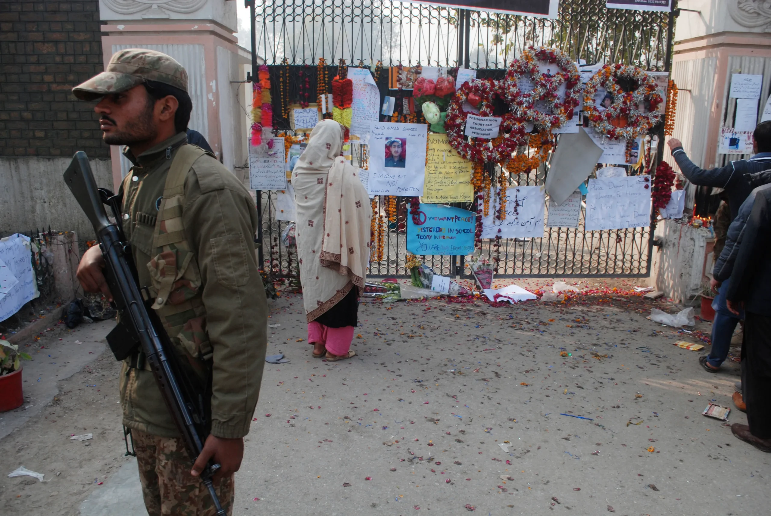
Observed as ‘National Resilience Day’ in Pakistan, October 8 this year commemorates the 17th anniversary of the national tragedy which inspired it—the 2005 Kashmir Earthquake, widely regarded as the deadliest earthquake in South Asia, which left over 87,000 people dead, a comparable number injured, and millions displaced. The tremors began at 08:50 Pakistan Standard Time in Pakistan-administered Azad Jammu and Kashmir (AJK), with the epicenter about 19 km northeast of its capital Muzaffarabad. However, its impact was also experienced in nearby Balakot in Khyber Pakhtunkhwa, as well as some areas of Indian-occupied Kashmir. The event registered maximum Mercalli intensity of XI (Extreme), and its magnitude was measured as a minimum of 7.6 on the moment magnitude scale by the United States Geological Survey (USGS).
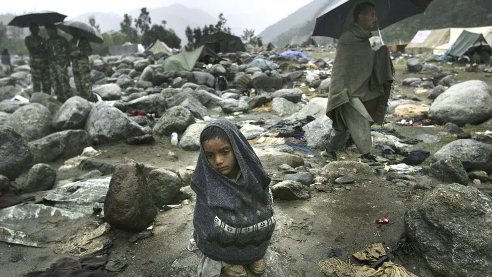
What had begun as tranquil as any other morning, the day is now etched in memory by somber reflections of the sheer scale of death and destruction, illustrated by widespread collapses of residential and other buildings, including 17,000 schools which accounted largely for the demise of 19,000 children among other casualties. The heart-wrenching imagery also captures the chaos, despair, and relief and rescue operations that were initially impeded by damaged land routes and telecommunication lines.
The expanse of the catastrophe may be unparalleled in the annals of Pakistan’s HISTORY, however, it is an opportune reminder that the tale of earthquakes in Pakistan neither begins nor ends with the incident.
On Shaky Ground
A previous significant earthquake shocked the nation and had become the stuff of legends until the tragic dawning of October 8, 2005. The 1935 Quetta earthquake, which struck in the wee hours of May 31 and was recorded to last for around three minutes, was assessed to have a magnitude of 7.7. Its epicenter was located 4 kilometers southwest of the Balochistan town of Ali Jaan. With tremors felt as distant as Agra, India, it destroyed much of Quetta and towns in the vicinity. Approximately 35,000 people perished during the calamity. However, history stands witness that the area had already experienced two significant earthquakes just four years prior. One of these was the earthquake that occurred on August 24, 1931, close to Sharigh, which was followed by another one on August 27, 1931, 9.5 km south of Mach. Regardless of these disastrous episodes, the nation has since then been plagued by innumerable minor and sporadic massive earthquakes.
Paradoxically, Pakistan owes much of this peril to perhaps what dominantly accounts for its magnificent landscape—its geology.
Geography: Blessing or a Curse?
Geographically, Pakistan lies in a region that has a high density of active faults and is one of the most SEISMICALLY active zones of Asia.
Pakistan is located at the intersection of three tectonic plates: the Indian, Eurasian, and Arabian Sea plates. The Indian plate, which collides with the Eurasian plate, causes the uplift that has produced the highest mountain peaks in the world, including the Himalayan, the Karakoram, the Pamir, and the Hindu Kush Ranges. Meanwhile, the coastal areas of Pakistan stretching from the provinces of Sindh to Balochistan incorporate active tectonic features. Menacingly put into perspective, the entire Makran coast can be classified as a seismically active zone. Also, meriting mention is the ‘Chaman fault’ system which is a significant fracture zone that starts near Kalat in the Northern Makran range, passes close to Quetta, and eventually extends north-northeast along Pakistan’s border with Afghanistan to Kabul, where it joins the Herat fault and eventually the Hindu Kush and Pamir ranges.
Risk Assessment and Mitigation
Thus, the question of how has, or rather, how should Pakistan prepare for the difficulties presented by the high seismic hazard in its area is also pertinent.
In the immediate aftermath of the 2005 Kashmir Earthquake, preliminary damage surveys were conducted to ascertain the extent of damages which later served as the foundation for a more elaborate Damage and Needs Assessment (DNA). This in turn contributed to a broad policy framework for recovery planning, which postulated rapid rebuilding of people’s livelihoods; independence and self-sufficiency; decentralization; emphasis on the most vulnerable social groups; ensuring development gains and poverty reduction; restoring capacities to manage recovery; transparency and accountability; averting new disaster risks; encouraging the engagement of private sector and civil society; and coordinated and coherent approaches to recovery.
In essence, ‘resilience’ not only encompasses the capacity for an adequate response to such disasters but mitigating their scale by certain practical measures. These may involve: 1) structural modifications to enhance the resistance quality of infrastructure in areas of high seismic activity; 2) augmenting capacities for emergency transmissions, data management, and response. Furthermore, all constructions, not just priority public buildings, can be made more resilient by satisfactory enforcement of building protocols and land-use legislation.
If any lessons can be drawn from Pakistan’s experience with earthquakes, they pertain to assessing risk hazards thoroughly and preparing sufficiently, so as to shield as many lives as possible from imminent, inescapable danger.
Also See: 5th June – World Environment Day